


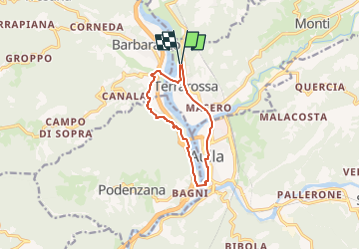

21 km | 33 km-effort


Tous les sentiers balisés d’Europe GUIDE+


Gratisgps-wandelapplicatie
 SityTrail
IGN / Geografische instituten
SityTrail World
De wereld gaat voor u open
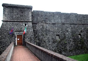
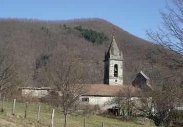
Tocht Te voet van 9,7 km beschikbaar op Toscane, Massa-Carrara, Licciana Nardi. Deze tocht wordt voorgesteld door SityTrail - itinéraires balisés pédestres.
Trail created by Unione di Comuni Montagna Lunigiana.
Whole route surveyed on foot 8.12.19


Te voet
Te voet

Stappen
Te voet

Wegfiets